
Whole of Yorkshire
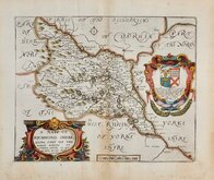
Yorkshire North Riding
( Page 1 of 3 )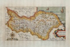
William Hole 1607
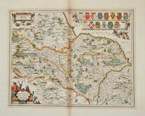
Jan Jansson 1646
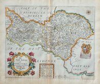
Richard Blome North Riding 1673
Richard Blome Richmondshire 1673
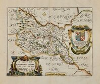
Richard Blome Richmondshire 1673
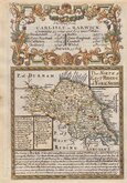
Robert Morden 1695 [1722]
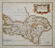
Emanuel Bowen 1720
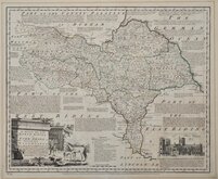
Emanuel Bowen 1763 [1777]


6x6 cm
AN UNCOMMON MAP FROM THE VERY RARE FIRST ISSUE.
YORKSHIRE, N. Riding
Sold by Luffman 28, Little Bell Alley, Coleman Street, London.
Miniature circular copper engraved map by John Luffman published in a geographical text book entitled A New Pocket Atlas and Geography of England and Wales.
John Luffman (1751-1821), engraver, cartographer, printer, author, publisher and bookseller, was born in London, the son of Richard Luffman, gentleman, and his wife, Margaret Biggs. His first recorded engraving work was for road maps in An actual Survey of the great post roads between London and Edinburgh by Mostyn John Armstrong 1776, and Taylor and Skinners survey and maps of the roads of North Britain or Scotland, also 1776. He is best known for the production of these miniature circular maps although issues were small, Luffman publishing only two editions in 1803 with one further issue in 1806 by Lackington Allen & Co. The maps were unchanged in all editions with the exception of the placement of the plate number which was re-engraved close to the outer ring of the map border for Luffmans second issue of 1803.
This example of the map of North Yorkshire is from the first issue of 1803 with the plate number '40' engraved 8mm above the map. A few small creases to top paper edge otherwise a good example from the very rare first issue.
Ref. Whitaker Printed Maps of Yorkshire [292]
Quick Links


Yorkshire West Riding

Yorkshire East Riding
×