
Yorkshire East Riding
Yorkshire North Riding
( Page 1 of 3 )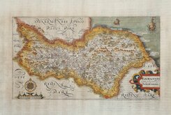
William Hole 1607
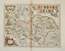
Jan Jansson 1646
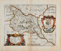
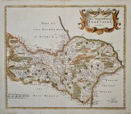
Richard Blome North Riding 1673
Richard Blome Richmondshire 1673
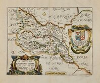
Richard Blome Richmondshire 1673
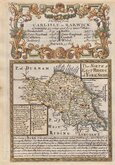
Robert Morden 1695 [1722]
Emanuel Bowen 1720
Emanuel Bowen 1763 [1777]


24x19 cm
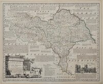
UNCOMMON LAURIE & WHITTLE EDITION.
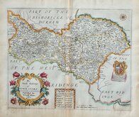
NORTH RIDING OF
YORKSHIRE
Engraved by B. Baker, Islington.
Published 12.th October, 1806, by LAURIE & WHITTLE, N.o 53, Fleet Street, London.
Copper engraving by Benjamin Baker first published in for The Universal Magazine of Knowledge and Pleasure..., W. Bent. from 1791 to 1797. This was the second series of county maps issued in the magazine, the first series by Emanuel Bowen and Thomas Kitchin was published between 1747-1766 by John Hinton. Baker's maps were based on the 'quarto' maps of John Cary published from 1787. This series is the first known work by Benjamin Baker who is also noted for his engraving work on the earliest maps for the Ordnance Survey until his retirement c.1824.
The maps also appeared unchanged in Maps of the Several Counties and Shires in England… Darton and Harvey, 1804. Finally, Laurie & Whittle published them with a number of revisions to the plate, including a compass rose and their imprint, in Laurie & Whittle's New and Improved English Atlas… 1807 & 1816.
This fine example is from the Laurie & Whittle publication. Original hand colour. Uncommon.
Quick Links


Yorkshire West Riding

Whole of Yorkshire
×