
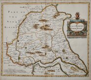
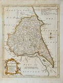
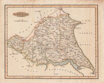
Yorkshire West Riding
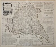
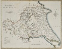
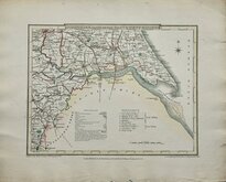
Yorkshire East Riding
( Page 1 of 2 )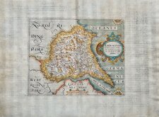
William Hole 1607
Robert Morden 1695
Emanuel Bowen 1720
Thomas Kitchin 1763 [1777]
Thomas Kitchin 1764
John Cary 1789 [1805]
Benjamin Baker 1796
George Cole 1808


51x43 cm
SCARCE. FROM THE ROYAL ENGLISH ATLAS.
A NEW MAP OF the EAST RIDING of YORK - SHIRE, Divided into its WAPONTAKES, &C. Drawn from Surveys, with various additional Improvements. Illustrated with HISTORICAL EXTRACTS relative to its Natural Produce, Mines, Minerals, Manufactures, Trade and Present State of its principal Towns.
By Tho.s Kitchin Geog.r
London. Printed for Rob.t Sayer & John Bennet. N.o53,Fleet Street. John Bowles, N.o13,Cornhill, & Carrington Bowles,N.o69 S.tPauls Church Yard. as the Act directs. 1.st of June 1777.
This series of maps, produced for The Royal English Atlas, were a reduction by two thirds of the maps from The Large English Atlas and were first published in 1763 three years after the first complete issue of the Large English Atlas. There were a number of re-issues in the 1770's and 1780's with the final publication in 1828 by R. Martin. It is clear though, from the scarcity of surviving examples, that the work was not a commercial success and the issues were small. As with the maps for the Large English Atlas, the engraving work was shared between Emanuel Bowen and Thomas Kitchin.
Thomas Kitchin (1719-1784), engraver, cartographer and publisher, born in London 4th August 1719, the son of Thomas Kitchin, hat-dyer, and his wife Mary Birr. Apprenticed to Emanuel Bowen (1693-1767) 6th December 1732 to 6th August 1746. He married his master’s daughter, Sarah Bowen, during his apprenticeship, 25th December 1739. Their son, Thomas Bowen Kitchin was born about 1740. An active Baptist, he was deacon of the Barbican Baptist Chapel in 1768 and married Jane Burroughs (1720?-1789), daughter of celebrated baptist preacher Joseph Burroughs (1685-1761). Engraver to the Duke of York from about 1758. Traded as Thomas Kitchin & Son from 1769 and was Hydrographer to the King from 1773. He probably retired sometime around 1776, his premises at The Star, Holborn Hill, which may have been run by his son since their partnership, was taken over by William Hawkes, an apprentice of his son in 1776/1777. He moved to Fishpool Street, St Albans in 1768 and died 23rd June 1784. He was buried in a private vault at St Albans Abbey, his memorial stone on the floor of the Abbey has not survived.
Some overall toning and staining from an old mount outside the plate mark. The reverse is evenly browned. Good margins all round. Original outline hand colour and a strong dark impression on heavy paper from the second edition published from 1778.
A very good example of a scarce map.
Ref. Whitaker Printed Maps of Yorkshire [248]
NOTE:
THIS MAP IS BEING SOLD HERE AS A SINGLE MAP BUT, UNTIL WE SELL AN INDIVIDUAL MAP FROM THE SET, WE HAVE THE FOUR YORKSHIRE MAPS (WEST, EAST & NORTH RIDINGS AND THE WHOLE OF YORKSHIRE) BEING OFFERED TOGETHER IN THE CATEGORY "WHOLE OF YORKSHIRE" AT A DISCOUNTED PRICE.
Quick Links


Whole of Yorkshire

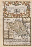
Yorkshire North Riding
×