
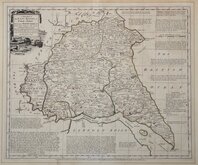
Whole of Yorkshire
Yorkshire East Riding
( Page 1 of 2 )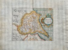
William Hole 1607
Robert Morden 1695
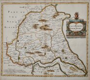
Emanuel Bowen 1720
Thomas Kitchin 1763 [1777]
Thomas Kitchin 1764
John Cary 1789 [1805]
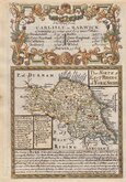
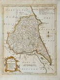
Benjamin Baker 1796
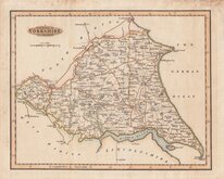
George Cole 1808


52x42 cm
"CARY STOCKDALE"
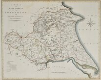
A MAP OF the EAST RIDING of YORKSHIRE. with AINSTY LIBERTY. From the best Authorities.
Published by John Stockdale Piccadilly 26th March 1805.
Engrav'd by J.Cary.
Copper engraving by John Cary (1755-1835). The maps were first issued in parts by T. Payne & Son, and G.G.J. & J. Robinson for Richard Gough's translation of William Camden's Britannia, the completed work being published in 1789. Following the death of Payne, the Robinson family sold the plates and publication rights to John Stockdale. Richard Gough was reportedly annoyed with the new arrangements and refused to work on the new edition and Stockdale completed the editorial work himself, expanding the work to four folio volumes and publishing them in 1806. Stockdale also used the plates in his New British Atlas from 1805 to 1809.
Small margins. Good clean example in fine hand colour. Folds as issued. Dated watermark of 1804.
Quick Links


Yorkshire West Riding

Yorkshire North Riding
×