
Staffordshire Maps
Worcestershire Maps
( Page 1 of 3 )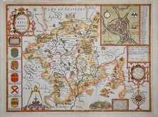
John Speed 1610 [1676]
Richard Blome 1673
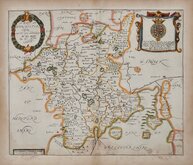
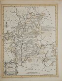
Robert Morden 1695
Emanuel Bowen 1720
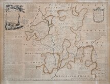
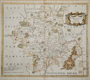
Emanuel Bowen 1756
Thomas Kitchin 1764
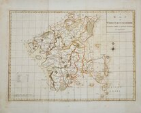
William Fowler 1765
John Haywood 1789


24x19 cm
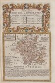
EARLY STEEL ENGRAVING WITH VIGNETTE OF WORCESTER CATHEDRAL.
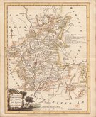
WORCESTER SHIRE
Published by Arch.d Fullarton & C.o
Steel engraving by Robert Scott first published in Bell's New and Comprehensive Gazetteer in 1833. The text for the gazetteer was largely copied from Lewis' Topographical Dictionary of 1831 and in 1839 Lewis obtained an injunction against Bell for plagiarism and the work was withdrawn. Archibald Fullarton, the publisher of Bell's Gazetteer republished the maps with new text in The Parliamentary Gazetteer from 1840 until 1849. Most of the maps were also copied from those in an earlier topographical dictionary, those by Sidney Hall prepared for John Gorton's Topographical Dictionary of Great Britain and Ireland published in 1831 as a rival to Lewis' work.
Good hand coloured example. Generous margins. Vignette of Worcester Cathedral. The addition of the Gloucester to Birmingham Railway and the incompletely erased "Glasgow" from the imprint, indicates this is from the 1843 edition of the Parliamentary Gazetteer.
Quick Links


Herefordshire Maps

Warwickshire Maps
×