
Parts Regions & Departments of France
Whole of France
( Page 1 of 5 )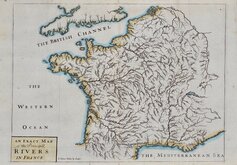
John Senex 1711
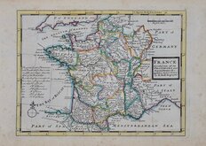
Herman Moll 1727
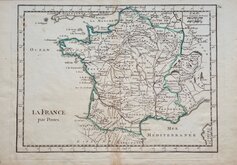
Georges Louis le Rouge 1756
Dilly & Robinson 1785
John Russell 1799
Delamarche 1806
Samuel Topham 1808
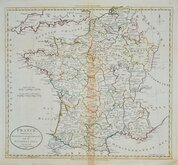
Michael Thomson 1816


24x19 cm
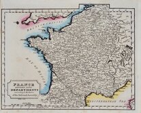
FRANCE. in Departments.
London, Published by Longman, Rees, Orme, Brown & Green, Paternoster Row.
Engraved by Sid.y Hall Bury Str.t Bloomsbury.
Engraved by Sidney Hall (1788?-1831) and published in An Atlas of Modern Geography, by Samuel Butler...London, Longman, Rees, Orme, Brown & Green, 1826.
Sidney Hall was born in or about 1788 and his work as an engraver began about 1809 with a map of the Austrian Dominions for William Faden in 1809. He was in partnership with Michael Thomson (fl.1809-1815) in 1814. Hall was a pioneer in engraving on steel producing steel engraved maps from from 1821. He married Selina Price in 1821 and died early in 1831 aged forty-two. Selina carried on his engraving business signing her maps simply "S. Hall" which has caused some confusion in map bibliographies. Hall was trading from the Bury Street address given with his signature on this map from 1816-1819.
Original hand colour. Ligh offsetting.
Quick Links

Whole of Europe

Whole of Britain & British Isles
×