
Whole of Europe
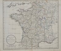
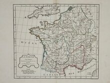
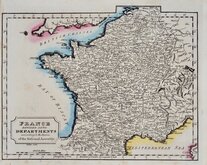
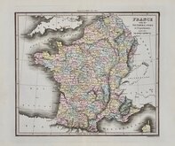
Whole of France
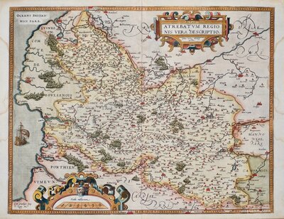
( Page 1 of 5 )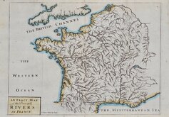
John Senex 1711
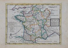
Herman Moll 1727
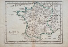
Georges Louis le Rouge 1756
Dilly & Robinson 1785
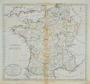
John Russell 1799
Delamarche 1806
Samuel Topham 1808
Michael Thomson 1816


56x43 cm
5 maps:
BELGIUM & HOLLAND PLATE 27
FRANCE-NORTH-WESTERN SECTION PLATE 28
FRANCE-NORTH-EASTERN SECTION PLATE 29
FRANCE-SOUTH-WESTERN SECTION PLATE 30
FRANCE-SOUTH-EASTERN SECTION PLATE 31
"The Times" ATLAS
THE EDINBURGH GEOGRAPHICAL INSTITUTE
JOHN BARTHOLOMEW & CO.
Five large double page colour printed lithographs by John Bartholomew & Son Ltd. published in The Times Survey Atlas of the World...Prepared at the "Edinburgh Geographical Institute" under the direction of J.G.Bartholomew, LLD., F.R.S.E., F.R.G.S. Cartographer to the King ...The Times, Printing House Square, London. 1922.
PLate 27 showing Northern France Belgium and Holland with inset plans of Brussels, Amsterdam, Antwerp and Rotterdam.
Plate 28 showing north west France with inset plans of Paris, Le Havre and environs of Brest.
Plate 29 showing north east France and part of Switzerland and Italy.
Plate 30 showing south west France with inset plan of Bordeaux.
Plate 31 showing south east France with inset plan of Marseille and map of Corsica.
All in good condition. Each map measures 42x56cm. or 56x43cm.
Quick Links


Whole of Britain & British Isles
Parts Regions & Departments of France
×