
Lancashire Maps
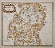
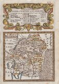
Westmorland Maps
( Page 1 of 4 )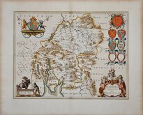
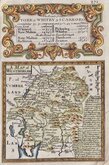
Jan Blaeu 1645
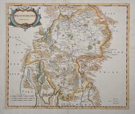
Robert Morden 1695 [1722]
Robert Morden 1695 [1753]
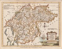
Emanuel Bowen 1720
Emanuel Bowen 1720
Joseph Ellis 1765 [1773]
John Cary 1787
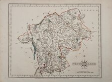
Robert Butters 1803


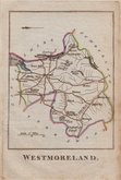
12x7 cm
COLOURFUL MINIATURE MAP.
WESTMORELAND
Pub. by M.A.Leigh 421 Strand | Sid.y Hall sculp.t
Miniature map engraved by Sidney Hall and first published by Samuel Leigh in Leigh's New Pocket Atlas of England and Wales in 1820. The demand for pocket atlases for the traveller was high during the first half of the 19th century and this little atlas, Samuel Leigh's only cartographic work, was very popular, running to ten editions with publications continued after his death by his widow and then his son until the final issues in 1842 & 3 when the plates had come into the hands of George Biggs.
Good hand coloured example from the first edition.
Quick Links


Yorkshire Maps

Cumberland Maps
×