
Lancashire Maps
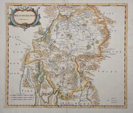
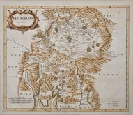
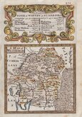
Westmorland Maps
( Page 1 of 4 )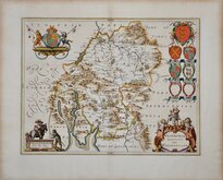
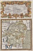
Jan Blaeu 1645
Robert Morden 1695 [1722]
Robert Morden 1695 [1753]
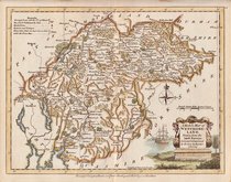
Emanuel Bowen 1720
Emanuel Bowen 1720
Joseph Ellis 1765 [1773]
John Cary 1787
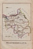
Robert Butters 1803


18x23 cm
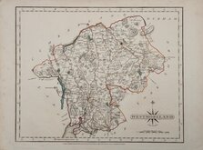
ORIGINAL COLOUR DEPICTING THE POOR LAW UNIONS
WESTMORLAND
Drawn by R.Creighton. | J.&C.Walker Sculpt.
ENGRAVED FOR LEWIS' TOPOGRAPHICAL DICTIONARY.
Copper engraving by the firm of J & C Walker from a drawing by Roger Creighton for publication in A Topographical dictionary of England… published by Samuel Lewis and Co. from 1831. The work achieved considerable success and was re-issued many times by Lewis until 1849. During this time the maps were amended and updated to include electoral information and the rapidly expanding railway network, with most counties known in at least six different states.
Good example with the addition of the poor-law unions indicated in original hand colour issued from 1840 to 1845.
Quick Links


Cumberland Maps

Yorkshire Maps
×