
Cumberland Maps
Westmorland Maps
( Page 1 of 4 )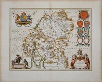
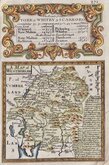
Jan Blaeu 1645
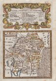
Robert Morden 1695 [1722]
Robert Morden 1695 [1753]
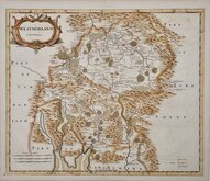
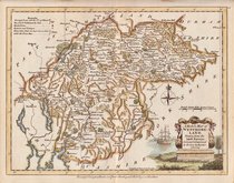
Emanuel Bowen 1720
Emanuel Bowen 1720
Joseph Ellis 1765 [1773]
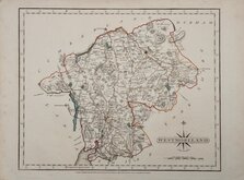
John Cary 1787
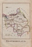
Robert Butters 1803


25x20 cm
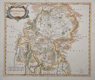
STEEL ENGRAVING WITH VIGNETTE OF BROUGH CASTLE.
WESTMORELAND
Pubd. by Archd. Fullarton & Co.
Steel engraving by Robert Scott first published in Bell's New and Comprehensive Gazetteer in 1833. The text for the gazetteer was largely copied from Lewis' Topographical Dictionary of 1831 and in 1839 Lewis obtained an injunction against Bell for plagiarism and the work was withdrawn. Archibald Fullarton, the publisher ofBell's Gazetteer republished the maps with new text in The Parliamentary Gazetteer from 1840 until 1849. The engraving work was shared between Gray & Son, James Neele and Robert Scott with most maps copied from those by Sidney Hall in an earlier topographical dictionary, John Gorton'sTopographical Dictionary of Great Britain and Ireland published in 1831.
This map of Westmorland is unsigned but bears the compass rose used by engraver Robert Scott. Vignette of Brough Castle. Very good clean example with large margins. Fine later hand colour.
SPECIAL OFFER MOUNT OPTION AVAILABLE AT CHECKOUT FOR UK POSTAGE
Quick Links


Yorkshire Maps

Lancashire Maps
×