
Yorkshire Maps
Westmorland Maps
( Page 1 of 4 )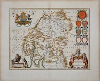
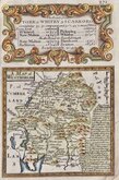
Jan Blaeu 1645
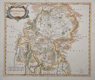
Robert Morden 1695 [1722]
Robert Morden 1695 [1753]
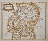
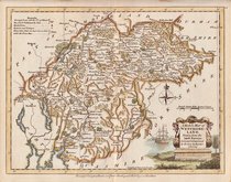
Emanuel Bowen 1720
Emanuel Bowen 1720
Joseph Ellis 1765 [1773]
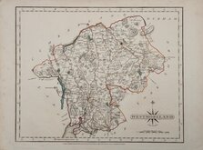
John Cary 1787
Robert Butters 1803


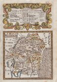
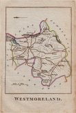
18x10 cm
ALSO KNOWN AS "CAPPER" OR "WHITAKER" MAPS. FIRST ISSUE.
WESTMORELAND
Published Jany.1.1808, by R.Phillips Bridge Street Blackfriars London.
Cooper del. et sculpt.
Copper engraving by Henry Cooper published by Richard Phillips in Benjamin Capper's Topographical Dictionary in 1808 and later publications of the same work by various publishers until 1839.
Good example in original wash hand colour from the first edition published by Richard Philips.
Quick Links


Lancashire Maps

Cumberland Maps
×