
Middlesex Maps
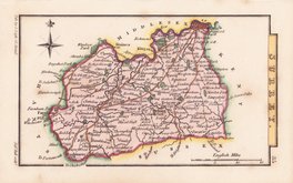
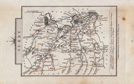
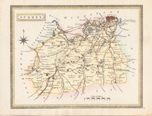
Surrey Maps
( Page 3 of 5 )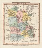
Charles Cooke 1806
John Cary 1808
Cole & Roper 1810
Samuel John Neele 1818
Sidney Hall 1820
John Cary 1822
John Heywood 1830 [1868]
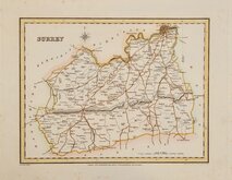
Roger Creighton 1831


24x18 cm
NEAT MAP FROM THE FIRST EDITION
SURREY
Drawn by R.Creighton. | Engraved by T.Starling Wilmington Square.
DRAWN AND ENGRAVED FOR LEWIS' TOPOGRAPHICAL DICTIONARY.
Copper engraving, by Thomas Starling (1796-1850) from a drawing by Roger Creighton (1796-1838) issued in A Topographical dictionary of England… published by Samuel Lewis and Co. from 1831. The work achieved considerable success and was re-issued many times by Lewis until 1849. During this time the maps were amended and updated to include electoral information and the rapidly expanding railway network, with most counties known in at least six different states.
Good example in fine hand colour from the first edition of 1831.
Quick Links


Sussex Maps

Kent Maps
×