
Dorset Maps
Somerset Maps
( Page 2 of 3 )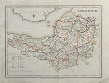
Roger Creighton 1831 [c.1842]
Gray & Son 1833 [1840]
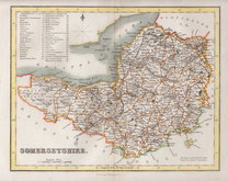
Joshua Archer 1834
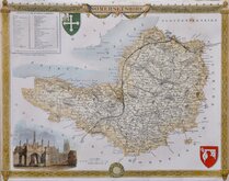
Thomas Moule 1837 [1842]
Joshua Archer 1842 [1858]
Joshua Archer 1842 [c.1843]
Francis Weller 1895
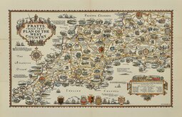
Alfred Taylor Pratts West Country 1932


31x24 cm
OUTLINE HAND COLOUR DEPICTING THE POOR LAW UNIONS
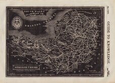
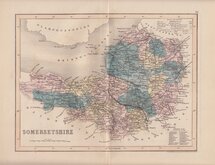
SOMERSETSHIRE
Drawn by R. Creighton. | Engraved by J.& C. Walker.
DRAWN AND ENGRAVED FOR LEWIS' TOPOGRAPHICAL DICTIONARY.
Copper engraving by the firm of J & C Walker from a drawing by Roger Creighton for publication in A Topographical dictionary of England… published by Samuel Lewis and Co. from 1831. The work achieved considerable success and was re-issued many times by Lewis until 1849. During this time the maps were amended and updated to include electoral information and the rapidly expanding railway network, with most counties known in at least six different states.
Good clean example in original outline hand colour. With the addition of the poor-law unions, this plate was issued between 1842 and 1849.
Ref. Chubb Printed Maps of Somerset. p.117.
Quick Links

Devon Maps

Gloucestershire Maps
×