
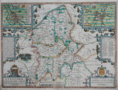
Staffordshire Maps
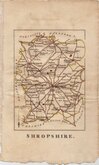
Shropshire Maps
( Page 1 of 3 )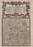
Emanuel Bowen 1720
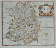
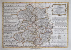
Robert Morden 1753
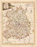
Thomas Kitchin 1763
Thomas Kitchin 1763
Emanuel Bowen 1770
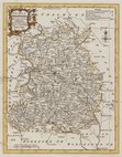
Joseph Ellis 1773
John Haywood 1788
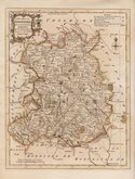
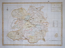
Robert Butters 1804


18x23 cm
Engraved by J Roper, drawn by George Cole. First state in fine original hand colour with the imprint of the publishers Vernor Hood & Sharpe and the note that it was drawn and engraved under the direction of E W Brayley to accompany his publication The Beauties of England and Wales. The maps were not actually published with this work but first issued in parts as a separate series between 1804 and 1810, first appearing in atlas form in The British Atlas (dated 1806).
.Quick Links
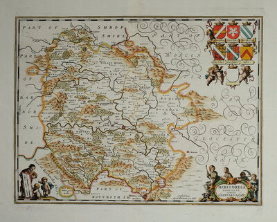
Herefordshire Maps

Wales Maps
×