
Leicestershire Maps
Rutland Maps
( Page 1 of 2 )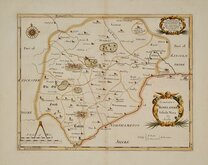
Robert Morden 1695 [1753]
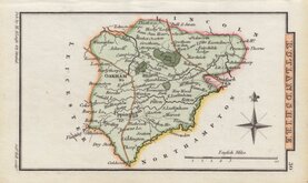
Emanuel Bowen 1720
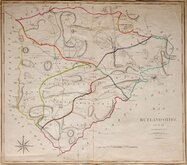
John Cary 1789 [1805]
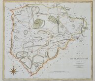
John Cary 1789 [1805]
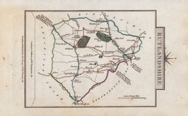
George Cole 1808
George Cole 1808 [1843]
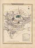
Sidney Hall 1820 [1833]
George & John Cary 1822


19x24 cm
BRIGHT HAND COLOUR.
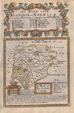
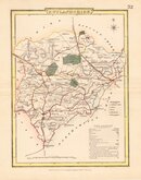
RUTLAND SHIRE
Pubished by Archd. Fullarton & Co.
Steel engraving by Robert Scott first published in Bell's New and Comprehensive Gazetteer in 1833. The text for the gazetteer was largely copied from Lewis' Topographical Dictionary of 1831 and in 1839 Lewis obtained an injunction against Bell for plagiarism and the work was withdrawn. Archibald Fullarton, the publisher of Bell's Gazetteer republished the maps with new text in The Parliamentary Gazetteer from 1840 until 1849. The engraving work was shared between Gray & Son, James Neele and Robert Scott with most maps copied from those by Sidney Hall in an earlier topographical dictionary, John Gorton'sTopographical Dictionary of Great Britain and Ireland published in 1831.
Robert Scott (1771-1841), born at Lanark 13 Nov 1771, the son of Robert Scott, a skinner and his wife Grizzell. He was apprenticed to Edinburgh engraver Alexander Robertson. He had premises in Edinburgh from 1797 to 1840, his Parliament Square premises occupied from 1810, were destroyed by fire in 1824. He died in January 1841 reputed to be the finest Scottish engraver of his time. Two of his sons, David Scott (1806-1849) and William Bell Scott (1811-1890) became notable artists.
Good hand coloured example. Later edition from The Parliamentary Gazetteer with Scott's signature and Fullarton's Glasgow address removed.
Quick Links


Northamptonshire Maps

Lincolnshire Maps
×