
Northamptonshire Maps
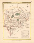
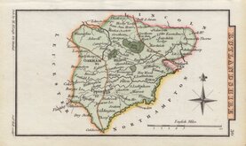
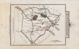
Rutland Maps
( Page 1 of 2 )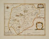
Robert Morden 1695 [1753]
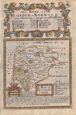
Emanuel Bowen 1720
John Cary 1789 [1805]
John Cary 1789 [1805]
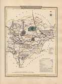
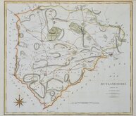
George Cole 1808
George Cole 1808 [1843]
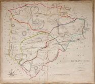
Sidney Hall 1820 [1833]
George & John Cary 1822


18x23 cm
COLE & ROPER
RUTLANDSHIRE
Drawn and Engraved under the direction of E.W. Brayley.
Engraved by J. Roper from a Drawing by G. Cole.| to accompany the Beauties of England and Wales.
London; Published for the Proprietors, by Vernor, Hood & Sharpe, Poultry, Dec.r 1.1808.
Engraved by John Roper (1771-1810), a London engraver and copperplate printer trading from New Street Square from 1797 until his death in 1810. His widow, Mary Roper, continued the business at the same address until at least 1846. This series of maps, most drawn by G[eorge?] Cole, were intended to accompany The Beauties of England and Wales. The maps were not actually published with this work but first issued in parts as a separate series between 1804 and 1810 and first appearing in atlas form in The British Atlas published by Vernor Hood & Sharpe (& nine other publishers) in 1810. The maps were re-issued in several publications including Dugdale's Curiosities of Great Britain until 1843. Their final appearance was by lithographic transfer in Collins' railway and pedestrian atlas… published by Darton and Co. in 1858.
Later red line under Essendine village otherwise a very good example from the first issue in original hand colour.
Quick Links


Lincolnshire Maps

Leicestershire Maps
×