
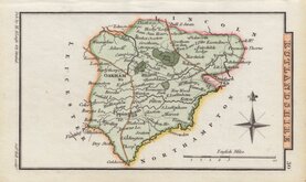
Lincolnshire Maps
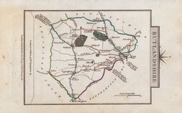
Rutland Maps
( Page 1 of 2 )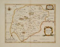
Robert Morden 1695 [1753]
Emanuel Bowen 1720
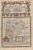
John Cary 1789 [1805]
John Cary 1789 [1805]
George Cole 1808
George Cole 1808 [1843]
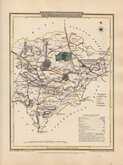
Sidney Hall 1820 [1833]
George & John Cary 1822


18x24 cm
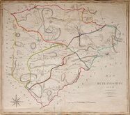
SHOWING THE COUNTY DIVIDED INTO THE POOR LAW UNIONS
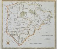
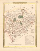
RUTLANDSHIRE
Drawn by R. Creighton Engraved by J & C Walker.
DRAWN AND ENGRAVED FOR LEWIS' TOPOGRAPHICAL DICTIONARY.
Copper engraving by brothers John Walker (1790?-1873) and Charles Walker (1799?-1872) trading as “J & C Walker” from about 1827. John Walker is known for his work for James Horsburgh and the East India Company as well as his work for the Admiralty and leading publishers of the period. He was founder member of the Royal Geographical Society in 1830. The map was drawn by Roger Creighton and published in A Topographical Dictionary of England…Samuel Lewis and Co. from 1831. The work achieved considerable success and was re-issued many times by Lewis until 1849. During this time the maps were regularly updated to include parliamentary and electoral information and changes to the rapidly expanding railway network.
This map includes the addition of the Poor Law Unions issued between 1840 and 1845.
Good example in original outline hand colour.
Quick Links


Leicestershire Maps

Northamptonshire Maps
×