
Road Maps
Regional Maps of England & Wales
( Page 3 of 10 )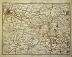
Bath Environs 1810

Hebner & Phillips South East 1821
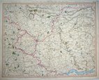
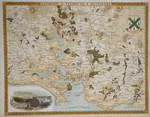
York 1825
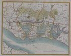
Portsmouth 1837
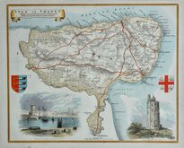
Thomas Moule Thanet 1837 [1842]
Plymouth & Devonport by Moule 1842
Cruchley Environs of London 1845
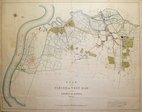
West Ham 1855

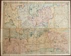
SOUTH EAST SHEET OF DISPATCH NEWSPAPER MAP OF ENGLAND AND WALES
THE DISPATCH ATLAS
ENGLAND AND WALES, SOUTH EAST SHEET
E.Weller, Lithogr.
Engraved by Edwd. Weller, Duke Strt. Bloomsbury.
First published in the Sunday supplement to the Weekly Dispatch Newspaper Sept. 18th 1859, the map of England and Wales was printed by lithographic transfer on four separate sheets from engraved plates by Edward Weller F.R.G.S. (1819-1884), one of the pioneers of lithograph printed maps.
When the series of county maps was complete, they were published in in The Dispatch Atlas in 1863. Publishers Cassell Petter and Galpin acquired the plates and published them in Cassell's Illustrated family paper and Cassell's British Atlas in 1867, By 1869, the firm of G.W.Bacon had acquired the plates issuing them under a number of titles for over forty years.
South East sheet with part blind stamp for the Sunday supplement lower left corner. Fine original colour.
Quick Links


Town Plans

Folding Maps
×