
Road Maps
Regional Maps of England & Wales
( Page 5 of 10 )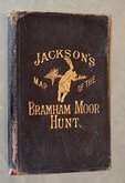
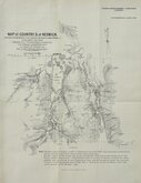
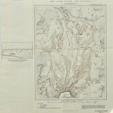
Jacksons Bramham Moor Hunt 1895

Farnborough 1906
South of Keswick Cumberland 1908
Long Valley Aldershot 1913
South East England 1930
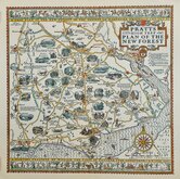
New Forest Alfred Taylor 1930
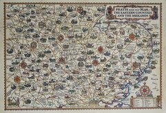
Alfred Taylor Pratts Eastern Counties and Midlands 1932
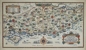
Alfred Taylor Pratts South Coast 1932


32x45 cm
NORTH EAST SHEET OF DISPATCH NEWSPAPER MAP OF ENGLAND AND WALES
THE DISPATCH ATLAS
ENGLAND AND WALES
BY EDWD. WELLER. F.R.G.S.
E. Weller, Lithogr.
First published in the Sunday supplement to the Weekly Dispatch Newspaper Sept. 18th 1859, this map of England and Wales was printed by lithographic transfer on four separate sheets from engraved plates by Edward Weller F.R.G.S. (1819-1884), one of the pioneers of lithograph printed maps.
When the series was complete, the maps were published in in The Dispatch Atlas in 1863. Publishers Cassell Petter and Galpin acquired the plates and published them in Cassell's Illustrated family paper and Cassell's British Atlas in 1867, By 1869, the firm of G.W.Bacon had acquired the plates issuing them under a number of titles for over forty years.
North East sheet with blind stamp for the Sunday supplement upper left corner. Fine original colour.
Quick Links


Town Plans

Folding Maps
×