
Folding Maps
Regional Maps of England & Wales
( Page 3 of 10 )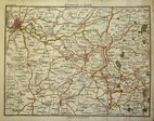
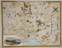
Bath Environs 1810

Hebner & Phillips South East 1821
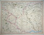
York 1825
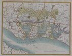
Portsmouth 1837
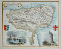
Thomas Moule Thanet 1837 [1842]
Plymouth & Devonport by Moule 1842
Cruchley Environs of London 1845
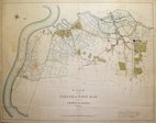
West Ham 1855

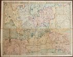
£15 Northern England. William Hughes
Ref: 5013G
Add to
basket
Thanks,Your Product Has Been Added To Basket

61x51 cm
COLOUR PRINTED.
ENGLAND AND WALES.
GEORGE PHILIP & SON LONDON & LIVERPOOL
Published in Philip's Imperial Library Atlas... edited by William Hughes F.R.G.S.... George Philip & Son, London and Liverpool, from about 1864.
William Hughes (1818?-1876) was a prolific mapmaker, geographer, engraver, printer and publisher from 1839 until his death in 1876.
Archival tape to marginal splits at centrefold top & bottom and to short tear in lower margin not affecting the printed area. Otherwise clean and undamaged.
Quick Links


Road Maps

Town Plans
×