
Town Plans
Regional Maps of England & Wales
( Page 1 of 10 )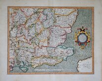
Gerard Mercator South East England 1630
Cumberland Northumberland Durham 1639
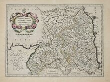
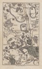
Essex Part Chapman and Andre 1777
Essex Part Chapman and Andre 1777
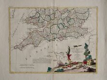
Southern Britain Zatta 1778
Kings Langley 1786
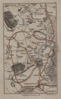
Barnet 1786
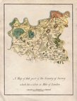
Cadell & Davies 1791


86x59 cm
POST CODE MAP HERTS AND BUCKS
HERTS AND BUCKS
BARTHOLOMEW/POST OFFICE POSTCODE MAP
GREAT BRITAIN & N. IRELAND SHEET 15
PRINTED AND PUBLISHED IN GREAT BRITAIN BY JOHN BARTHOLOMEW&SON LTD
© JOHN BARTHOLOMEW & SON LTD., EDINBURGH & POST OFFICE LONDON
Sheet 15 titled HERTS AND BUCKS but also including most of Middlesex and North London and parts of Essex, from a series of 63 maps covering Great Britain and Northern Ireland, produced at a scale of Half Inch to a Mile by John Bartholomew & Son and The Post Office and published in 1974. Overprinted in red with postcodes and postcode boundaries.
Unfolded, some overall light creasing but generally good condition.
Quick Links


Folding Maps

Road Maps
×