
Buckinghamshire Maps
Oxfordshire Maps
( Page 1 of 3 )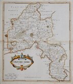
Robert Morden 1695 [1722]
Emanuel Bowen 1720
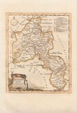
Thomas Kitchin 1749 [1769]
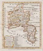
Emanuel Bowen 1758
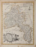
Thomas Kitchin 1763 [1764]
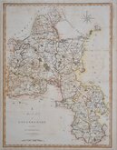
John Cary 1789 [1805]
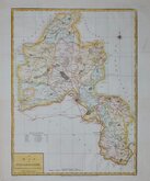
John Haywood 1791
Benjamin Baker 1793


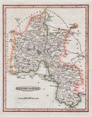
11x17 cm
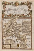
MINIATURE MAP WITH TEXT & DITANCE TABLES
OXFORDSHIRE.
Pigot & Slater. Engravers Manchr.
Lithographic transfer produced by James Pigot and Isaac Slater for publication in Pigot & Co.'s pocket atlas, topography and gazetteer of England…London and Manchester J. Pigot & Co. (1839). The work was issued twice more in 1841 and 1850 and individual county sections were probably issued separately. James Pigot (1769-1843) is well known for his steel engraved county maps and his directories published from 1826 and this series of lithograph printed maps were based on his steel engraved series, but this miniature work did not achieve the success of his earlier publications and the maps are uncommon today.
The map is set a little low on the page with consequent loss of publisher’s imprint, otherwise a very good example with the 14 typeset pages of description of the county, vignette of Christ Church Cathedral Oxford and Distance Tables.
Quick Links


Berkshire Maps

Town Plans
×