
Town Plans
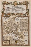
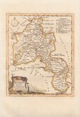
Oxfordshire Maps
( Page 1 of 3 )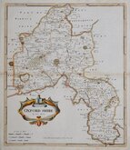
Robert Morden 1695 [1722]
Emanuel Bowen 1720
Thomas Kitchin 1749 [1769]
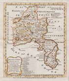
Emanuel Bowen 1758
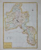
Thomas Kitchin 1763 [1764]
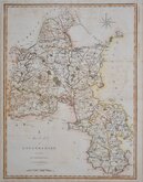
John Cary 1789 [1805]
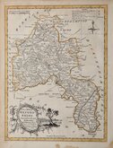
John Haywood 1791
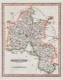
Benjamin Baker 1793


18x23 cm
NEAT, FINELY ENGRAVED MAP
OXFORDSHIRE
Engraved by B.Baker Islington
This series were first published in The Universal Magazine of Knowledge and Pleasure by John Hinton from 1791 to 1797. They were then published in Maps of the several counties and shires in England by Darton and Harvey in 1804, and finally, with amendments in Laurie & Whittle's New and Improved English Atlas in 1807 and 1816.The engraver, Benjamin Baker, was engaged for much of his career, on the earliest maps for the Ordnance Survey
This fine example, in line and was hand colour, is the first state published in The Universal Magazine in 1793.
Quick Links


Buckinghamshire Maps

Berkshire Maps
×