
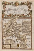
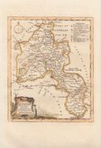
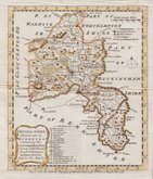
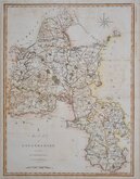
Buckinghamshire Maps
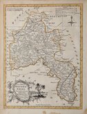
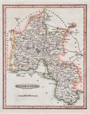
Oxfordshire Maps
( Page 1 of 3 )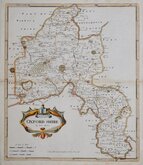
Robert Morden 1695 [1722]
Emanuel Bowen 1720
Thomas Kitchin 1749 [1769]
Emanuel Bowen 1758
Thomas Kitchin 1763 [1764]
John Cary 1789 [1805]
John Haywood 1791
Benjamin Baker 1793


46x51 cm
FIRST TO SHOW LONGITUDE FROM GREENWICH
A NEW MAP of the COUNTY of OXFORD Divided into Hundreds
LONDON Printed for C.SMITH No.172 Strand. January 6th. 1801.
Engraved by the firm of Jones and Smith, this series of large county maps were produced for Smith's New English Atlas being a complete set of County Maps, Divided into Hundreds...first published by C. Smith, London 1804. The maps were also issued separately from 1801. Charles Smith, was a stationer and map seller working from The Strand from 1800 to 1852. He was probably not related to the engraving firm of Smith and Jones. The publication of this work predated John Cary’s Cary's New English Atlas, a work of striking similarity, by 5 years. This was the first series of county maps to show longitude measured from the Greenwich meridian.
Some toning from the pasted guard verso at the centrefold but still a very good example in bright original hand colour, generous margins with no tears or repairs, from the first issue dated 1801 and published in 1804.
Quick Links


Berkshire Maps

Town Plans
×