
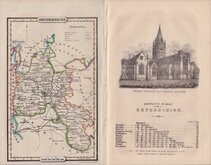
Buckinghamshire Maps
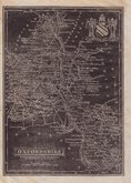
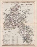
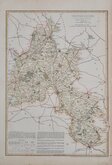
Oxfordshire Maps
( Page 3 of 3 )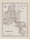
Roger Creighton 1831 [1845]
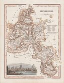
Robert Scott 1833
Joshua Archer 1833
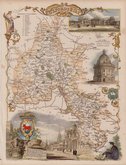
Thomas Moule 1837 [1842]
James Pigot 1839
Joshua Archer 1842 [1846]
Benjamin Rees Davies 1863 [1867]


17x21 cm
FROM ENGLAND DISPLAYED
OXFORDSHIRE Drawn from a SURVEY and Regulated by ASTRON:L OBSERVAT:NS By T.Kitchin, Geogr:.r
Engraved by Thomas Kitchin for publication in The London Magazine by Richard Baldwin. The magazine was published monthly between 1st May 1732 and 1st July 1783, the county maps appearing one at a time at irregular intervals between 1747 and 1763, the map of Oxfordshire appearing in the issue for January 1749. 10 of the maps appeared in England Displayed…London, S. Bladon et.al. 1769. The complete series were re-issued under various titles including Boswell's Antiquities by Alexander Hogg from 1786 to 1798.
Thomas Kitchin (1719-1784), one of the foremost engravers of his time, was apprenticed to Emanuel Bowen in 1732 and married his daughter, Sarah, at the end of his apprenticeship in 1739. His works include the map of Scotland by Elphinstone, maps for Geographia Scotiae, the London Magazine and The Large English Atlas working with his father in law Emanuel Bowen.
Oxfordshire was one of the 10 maps that appeared in England Displayed and this example is from that work.
Good clean example in neat later hand colour.
Quick Links


Berkshire Maps

Town Plans
×