
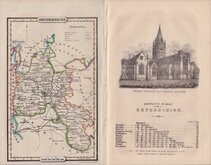
Berkshire Maps
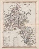
Oxfordshire Maps
( Page 3 of 3 )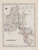
Roger Creighton 1831 [1845]
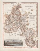
Robert Scott 1833
Joshua Archer 1833
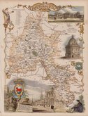
Thomas Moule 1837 [1842]
James Pigot 1839
Joshua Archer 1842 [1846]
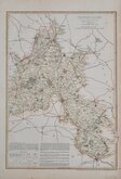
Benjamin Rees Davies 1863 [1867]


10x15 cm
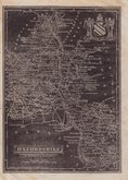
LATE ISSUE FROM CARY'S TRAVELLERS COMPANION WITH NORTH TO THE TOP
OXFORDSHIRE
London. Published by G.& J.Cary. No.86 St.James's Str.
A re-engraved and revised version of of the map issued by John Cary in 1806 which in turn, was a re-engraved version of his 1789 map. All were issued under the title of Cary's Traveller's Companion, a highly successful work necessitating the re-engraving of worn plates to continue publication. This issue, published with his brother George, between 1822 and 1835, was the only version with place names on the map engraved to read with North at the top, the title, imprint and distances from London being engraved sideways. The final issue was by lithographic transfer in Crutchleys' Railroad Companion to England and Wales...in 1862.
Light fingermarking to lower edge. Good example of the 1st state of the re-engraved plate of 1822 in original hand colour. Generous margins.
Quick Links


Buckinghamshire Maps

Town Plans
×