
Berkshire Maps
Oxfordshire Maps
( Page 1 of 3 )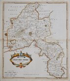
Robert Morden 1695 [1722]
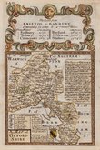
Emanuel Bowen 1720
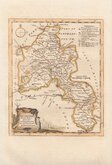
Thomas Kitchin 1749 [1769]
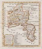
Emanuel Bowen 1758
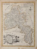
Thomas Kitchin 1763 [1764]
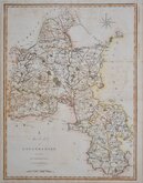
John Cary 1789 [1805]
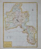
John Haywood 1791
Benjamin Baker 1793


17x23 cm
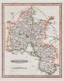
WOODBLOCK ENGRAVED MAP
OXFORDSHIRE
London Published for the Proprietors by W.Edwards, 12 Ave Maria Lane.
J.Archer sc. 100 Drummond Str. Euston Sq.
Woodblock engraved map by Joshua Archer. The woodblock was inked with a roller without working the ink into the engraved cuts thereby printing with a white line on a black ground. Published in parts by W. Edwards in The Guide to Knowledge edited by W Pinnock from 1833 The printing method was not popular for topographic maps and was not used again for English county maps. The woodblocks were later published by Thomas Johnson printed more conventionally by lithographic transfer in his rare publication Johnson's Atlas of England in 1847 & 1863.
This example from The Guide to Knowledge has stitch holes to left margin and an 11cm tear into the map from the right margin skillfully repaired with archival tissue verso.
Quick Links


Town Plans

Buckinghamshire Maps
×