
Buckinghamshire Maps
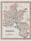
Oxfordshire Maps
( Page 1 of 3 )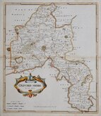
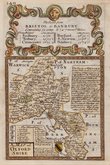
Robert Morden 1695 [1722]
Emanuel Bowen 1720
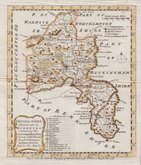
Thomas Kitchin 1749 [1769]
Emanuel Bowen 1758
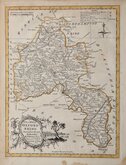
Thomas Kitchin 1763 [1764]
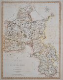
John Cary 1789 [1805]
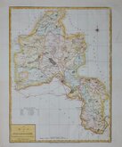
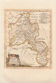
John Haywood 1791
Benjamin Baker 1793


40x52 cm
STOCKDALE EDITION
A MAP of OXFORDSHIRE from the best AUTHORITIES
Published by John Stockdale Piccadilly 26.th March 1805.
Engraved by J. Cary.
E. Noble delint & curavit
Drawn by Edward Noble and engraved on copper by John Cary. The maps were first issued in parts by T.Payne & Son, and G.G.J. & J.Robinson for Richard Gough's translation of William Camden's Britannia, the completed work being published in 1789. Following the death of Payne, John Stockdale purchased the plates, publishing them in a further expanded edition of Britannia in1806 and in his New British Atlas from 1805 to 1809.
John Cary (1755-1835) was a prolific engraver and publisher of maps and set new standards of quality and accuracy with his productions. Born at Corsley, Wiltshire in 1754, the second of four sons to George, maltster and churchwarden, and Mary Cary. He served an apprenticeship to engraver William Palmer from 1770-1777. The first map to bear his name is a canal map of 1779. He married Ann Jackson on 21st June 1779 at St, Bride Fleet Street. Three of his brothers also moved to London: George (1753-1830), a haberdasher with premises in The Strand, and Francis (1756-1836), and William (1759-1825). Both Francis and William were also involved in cartography and engraving; Francis being apprenticed to engraver James Taylor and William serving with Jesse Ramsden, the renowned instrument maker. John Cary was appointed Surveyor of Roads to the General Post Office in 1794,. He won the Gold Medal of the Royal Society of Arts for his large scale map of Cardiganshire. The Strand premises burned down on 17th January 1820 and Cary retired, to a house on the Kings Road, Chelsea. The business was continued by his sons George (1787-1859) and John ( 1791-1852). He died at Mortlake on 16th August 1835 and was buried at Kensington. He left the freehold of two properties and a third leasehold in the Strand to his sons and a life interest in the Kings Road property to his daughter.
Edward Noble (c.1728 -1784) was a journeyman bookseller and draughtsman. He worked as foreman to printer John Nichols. Author of The Elements of linear perspective demonstrated by geometrical principles…1771.
From the Stockdale edition of 1805. Horizontal folds as issued, some light offsetting but still a good map good hand colour.
Quick Links


Town Plans

Berkshire Maps
×