
Town Plans
Oxfordshire Maps
( Page 1 of 3 )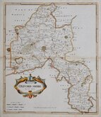
Robert Morden 1695 [1722]
Emanuel Bowen 1720
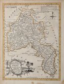
Thomas Kitchin 1749 [1769]
Emanuel Bowen 1758
Thomas Kitchin 1763 [1764]
John Cary 1789 [1805]
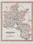
John Haywood 1791
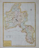
Benjamin Baker 1793


20x26 cm
FINE HAND COLOUR
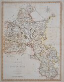
OXFORDSHIRE.
Neele Sculpt. Strand.
Published by J.Robins & C.o Albion Press London January 1.st1818.
Drawn and engraved by Samuel John Neele, this series were based on John Cary's 'quarto' maps of 1793. The early publication of this series is complex with loose issues and parts issues for many counties from about 1812. The first main publication containing the complete set of county maps was The New British Traveller; or, modern panorama of England and Wales...By James Dugdale... published about 1818 by J & J Cundee. The map appeared in three further issues under different titles in 1819 and 1820.
Small top margin but a good example from the second edition dated 1818 but published in 1819. Fine hand colour.
Quick Links


Buckinghamshire Maps

Berkshire Maps
×