
Hertfordshire Maps
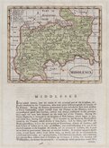
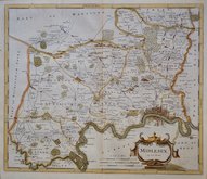
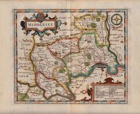
Middlesex Maps
( Page 1 of 5 )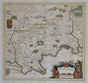
Jan Blaeu 1645

Jan Jansson 1646

Jan Jansson 1646 [1714]
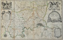
John Seller & John Oliver 1679 [1714]
John Seller 1694 [c.1784]
Robert Morden 1695 [1753]
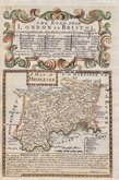
Emanuel Bowen 1720
John Senex 1724


25x20 cm
NEAT HAND COLOUR.
MIDDLESEX.
Neele Sculpt. Strand.
Drawn and engraved by Samuel John Neele (1758-1824), this series were based on John Cary's 'quarto' maps of 1793. The early publication of this series is complex with loose issues and parts issues for many counties from about 1812. The first main publication containing the complete set of county maps was The New British Traveller; or, modern panorama of England and Wales...By James Dugdale... published about 1818 by J & J Cundee. The map appeared in three further issues under different titles in 1819 and 1820.
Small left margin and stitch holes bottom margin are re-margined in matching paper otherwise a good clean example in good hand colour.
Quick Links


Environs of London

Central London
×