
Central London
Middlesex Maps
( Page 1 of 5 )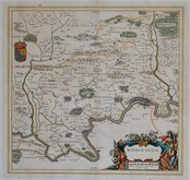
Jan Blaeu 1645

Jan Jansson 1646

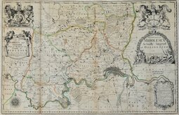
Jan Jansson 1646 [1714]
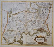
John Seller & John Oliver 1679 [1714]
John Seller 1694 [c.1784]
Robert Morden 1695 [1753]
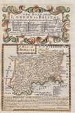
Emanuel Bowen 1720
John Senex 1724


23x16 cm
FIRST ISSUE. NEAT HAND COLOUR.
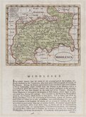
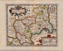
MIDDLESEX
Drawn by R.Creighton. | Engraved by T.Starling. London.
DRAWN AND ENGRAVED FOR LEWIS' TOPOGRAPHICAL DICTIONARY.
Copper engraving by Thomas Starling (1796-1850) from a drawing by Roger Creighton issued in A Topographical dictionary of England… published by Samuel Lewis and Co. from 1831. The work achieved considerable success and was re-issued many times by Lewis until 1849. During this time the maps were amended and updated to include electoral information and the rapidly expanding railway network, with most counties known in at least six different states.
Good clean example from the first issue of 1831 in fine hand colour.
Quick Links


Environs of London

Hertfordshire Maps
×