
Nottinghamshire Maps
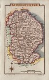
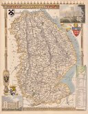
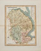
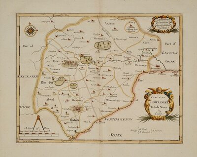
Lincolnshire Maps
( Page 2 of 3 )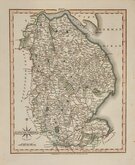
John Cary 1809
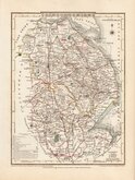
George Cole 1810
Sidney Hall 1820

Roger Creighton 1831
Thomas Moule 1831 [1842]
James Pigot 1839
Gray & Son 1840

Joshua Archer 1842 [1858]


22x27 cm
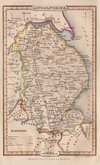
CARY'S QUARTO SERIES. INCLUDING TEXT PAGE.
LINCOLNSHIRE
By JOHN CARY, Engraver.
London. Published by J. Cary, Engraver & Mapseller N.o 181 Strand July 1.st 1809.
Copper engraving by John Cary. This series of maps, commonly known as his "quarto" series, were published in Cary's New and Correct English Atlas and were justifiably popular, running to many editions from 1787 until about 1804. Re-engraved plates extended the life of the series from 1808 to 1843 and lithographic transfers from the plates by later publishers continued publication until about 1876 - a life of nearly 90 years.
This example of the map of Cheshire is from the re-engraved plate published in Cary's New and Correct English Atlas of 1809 and is a lovely example in fine original hand colour. Includes page of text description of the county.
Ref. Carroll Printed Maps of Lincolnshire 65 (i)
Quick Links


Cambridgeshire Maps
Rutland Maps
×