
Yorkshire Maps
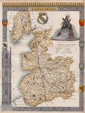
Lancashire Maps
( Page 2 of 3 )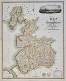
James Franks 1824
John Heywood 1830 [c.1856]
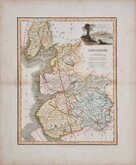
J & C Walker 1831 [1836]
Roger Creighton 1831 [1840]
Robert Scott 1833 [1840]
Thomas Moule 1837 [1842]
Joshua Archer 1842 [1860]
Edward Weller 1863 [1864]


24x31 cm
HAND COLOURED DEPICTING THE POOR LAW UNIONS
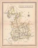
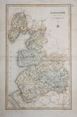
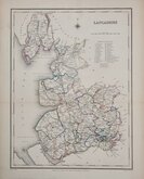
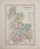
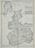
LANCASHIRE
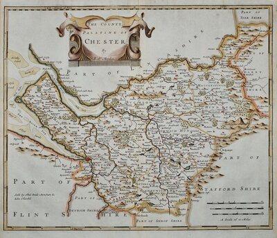
Drawn by R. Creighton |Engraved by J.& C. Walker
DRAWN AND ENGRAVED FOR LEWIS' TOPOGRAPHICAL DICTIONARY.
The map was drawn by Roger Creighton (1796-1838) draughtsman and surveyor. Born at Tynemouth, he is first recorded as a land-surveyor in Wakefeld and perhaps trained under Christopher Greenwood with whom he worked on his series of county maps from 1818. He married Martha Gostling 16 Jan 1823 at St George Hanover Square and is variously recorded on the baptismal records of their children as draughtsman or surveyor between 1824 and 1834. He became the principal draughtsman for the Topographical Dictionary by Samuel Lewis. He was buried 9 April 1838 at St.Luke Chelsea.
Engraved on copper by brothers John Walker (1790?-1873) and Charles Walker (1799?-1872) trading as “J & C Walker” from about 1827. John Walker is known for his work for James Horsburgh and the East India Company as well as his work for the Admiralty and leading publishers of the period. He was founder member of the Royal Geographical Society in 1830.
Published by Samuel Lewis (1782-1865) in A Topographical Dictionary of England…Samuel Lewis and Co. from 1831. The work achieved considerable success and was re-issued many times by Lewis until 1849. During this time the maps were regularly updated to include parliamentary and electoral information and changes to the rapidly expanding railway network. Lewis later claimed that the work had taken six years to complete at a cost of £48,000.
Fine example in original outline hand colour depicting the Poor Law Unions identifying this issue as the 1840 edition of Lewis' Topographical Dictionary.
Quick Links


Westmorland Maps
Cheshire Maps
×