
Yorkshire Maps
Lancashire Maps
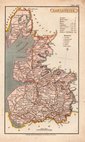
( Page 1 of 3 )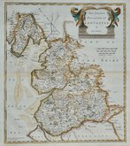
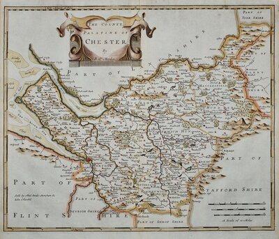
Robert Morden 1695

Emanuel Bowen 1720

Thomas Kitchin 1750 [c.1786]
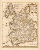
Thomas Kitchin 1763
John Cary 1787 [1808]
John Cary 1789 [1805]
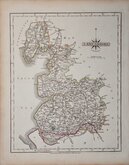
Henry Cooper 1808 [c.1825]

John Cary 1822


46x65 cm
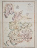
DISPATCH MAP. CASSELL EDITION
LANCASHIRE
BY EDWD. WELLER, F.R.G.S.
MACLURE,MACDONALD & MAGREGORS, STEAM LITHO:MACHINES.LONDON
LONDON, PUBLISHED BY CASSELL, PETTER & GALPIN, LA BELLE SAUVAGE YARD LUDGATE HILL. E C
Commencing publication in 1859, this series of maps were printed by lithographic transfer from an engraved plate for The Weekly Dispatch Newspaper. The engraving work for the series was shared between Edward Weller, John Dower, and Benjamin Rees Davies. The maps were published in parts issues and when the series was complete, in The Dispatch Atlas in 1863. The publishers Cassell Petter and Galpin acquired the plates publishing them as loose sheets from 1864 and in Cassell's Illustrated family paper and Cassell's British Atlas in 1867. By 1869, the firm of G. W. Bacon had acquired the plates and published them in a number of titles for over forty years.
Printed by Mclure, Macdonald and Macgregor's "steam litho:machines" for Cassell Petter & Galpin c.1864. Pasted on linen and hand coloured. Two horizontal and one vertical fold with pasted guard verso for binding. Some wear at fold intersections. Some general wrinkling to the paper. Occasional marks.
Quick Links


Westmorland Maps
Cheshire Maps
×