
Westmorland Maps
Lancashire Maps
( Page 1 of 3 )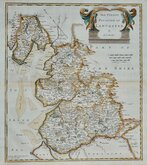
Robert Morden 1695

Emanuel Bowen 1720

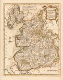
Thomas Kitchin 1750 [c.1786]
Thomas Kitchin 1763
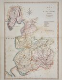
John Cary 1787 [1808]
John Cary 1789 [1805]
Henry Cooper 1808 [c.1825]

John Cary 1822


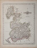
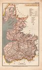
19x24 cm
STEEL ENGRAVING WITH VIGNETTE OF LANCASTER
LANCASHIRE
Pubd. by Archd. Fullarton & Co. Glasgow.
Steel engraving first published in Bell's New and Comprehensive Gazetteer from 1833. The text for the gazetteer was largely copied from Lewis' Topographical Dictionary of 1831 and in 1839 Lewis obtained an injunction against Bell for plagiarism and the work was withdrawn. Archibald Fullarton, the publisher of Bell's Gazetteer, republished the maps with new text in The Parliamentary Gazetteer from 1840 until 1849.
The engraving work was shared between Gray & Son, James Neele and Robert Scott with most maps copied from those by Sidney Hall in an earlier topographical dictionary; John Gorton's Topographical Dictionary of Great Britain and Ireland published in 1831.
Robert Scott (1771-1841), born at Lanark 13 Nov 1771, the son of Robert Scott, a skinner and his wife Grizzell. He was apprenticed to Edinburgh engraver Alexander Robertson. He had premises in Edinburgh from 1797 to 1840, his Parliament Square premises occupied from 1810, were destroyed by fire in 1824. Reputed to be the finest Scottish engraver of his time, he died in January 1841. Two of his sons, David Scott (1806-1849) and William Bell Scott (1811-1890) became notable artists.
Although the Lancashire map is unsigned, the engraver can be identified as Robert Scott by the style of compass rose. The addition of railways indicate that this map was published in an edition of The Parliamentary Gazetteer from 1840.
Good hand coloured example.
Quick Links

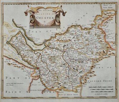
Cheshire Maps

Yorkshire Maps
×