
John Cary
John Senex
( Page 1 of 3 )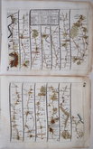
London Bristol
London Banbury
London St Davids
London Harwich
London Towcester
London Lands End
London Newhaven
London Barnstaple


£100 Newcastle-under-Lyme Carlisle
Ref: 6002.37
Add to
basket
Thanks,Your Product Has Been Added To Basket

21x16 cm
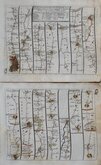
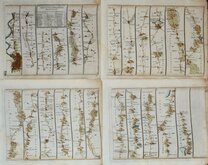
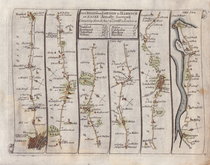
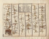
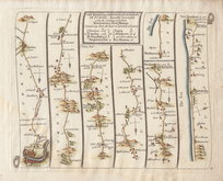
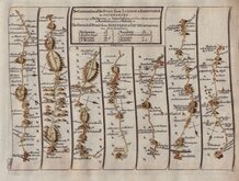
The ROAD from LONDON to CARLISLE in CUMBERLAND Commencing at Darlaston in the Holy-head Road.
Plates 37 & 38
Pair of maps showing the complete route to Carlisle from Barlaston Bridge at Meaford off the London to Holyhead road showing Tittensor, Hanford, Newcastle-under-Lyme, Chesterton, Talke, Odd Rode, Rode Hall, Brereton Green, Holmes Chapel, Cranage, Lostock Gralam, Stretton, Stockton Heath, Warrington, Winwick, Newton-le-Willows, Ashton-in-Makerfield, Wigan, Standish, Coppull Moor, Charnock Richard, Preston, Barton, Garstang, and on the next map, Garstang, Ellel, Burrow, Scotforth, Lancaster, Slyne, Bolton-le-Sands, Carnforth, Burton-in-Kendal, Holme, Natland, Kendal, Shap, Thrimby, Brougham Castle, Penrith, Hutton Hall, High Hesket, Low Hesket, Carleton, and Carlisle.
From the first issue of An Actual Survey of all the Principal Roads of England and Wales...London: Printed for and sold by J. Senex at the Globe in Salisbury-Court, Fleet Street, 1719.
Good clean maps in neat later hand colour.
Quick Links

Owen & Bowen

John Ogilby
×