
Mediterranean
Historical Maps
( Page 1 of 10 )
Saxon Heptarchy Robert Morden 1695

Roman Britain Robert Morden 1695
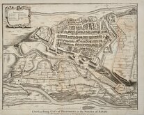
Cuneo Piedmont Savoy 1727
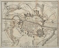
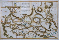
Siege of Tournai 1727
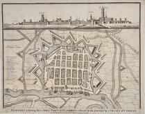
Nieuwpoort Belgium 1727
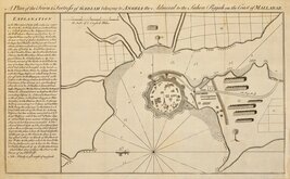
Vijaydurg Fort 1756
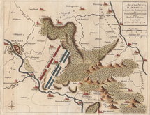
Battle of Hastenbeck 1757
Battle of Kolin 1757

£30 William Holgate Estate Romford
Ref: 1167g
Add to
basket
Thanks,Your Product Has Been Added To Basket

97x60 cm
AN | Exact Survey of Severall Parcell's of land lying. | near Rumford in the Parish of Hornchurch in the County | of ESSEX Belonging to WmHolgate Esqr. | Described in the year 1696 and found to containe 373. Acres-3 | Roods & 27 Perches -By W:m Stane.
Vincent Brooks, Day & Son, Lith. London WC.
Large lithograph reproducing a late 17th century plan of the estate of William Holgate in 1696 extending from Hornchurch Lane to Squirrels Heath. William Holgate sold the the estate to John Wood in 1708. Showing art of Romford with St Edwards Church at the bottom of the page. North is to the bottom.
Vincent Brooks (1815-1885) printer, publisher, stationer. Lithographer to the Queen. His father, John Brooks was an established printer with premises in Oxford Street, Vincent became partner in "John Brooks & Son" before succeeding to the business in 1839. He acquired the name of "Day & Son" in 1867, the firm then becoming Vincent Brooks, Day & Son. The business was very successful, recorded as employing 148 men and 40 boys. He died at Drury Lane, London, 29 Sep 1885 The firm continued until 1940.
This plan is folded in quarters. Some chips and tears at margins and at folds. Two small holes (in Hartfield and Clovergrass Field).
Quick Links


Europe

Road Maps
×