
Road Maps
Historical Maps
( Page 1 of 10 )
Saxon Heptarchy Robert Morden 1695

Roman Britain Robert Morden 1695
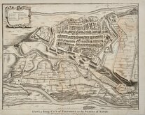
Cuneo Piedmont Savoy 1727
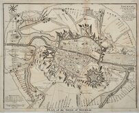
Siege of Tournai 1727
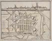
Nieuwpoort Belgium 1727
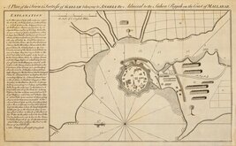
Vijaydurg Fort 1756
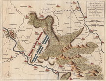
Battle of Hastenbeck 1757
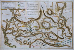
Battle of Kolin 1757


£20 Southern Britain in the Iron Age
Ref: 1756gt
Add to
basket
Thanks,Your Product Has Been Added To Basket

104x84 cm
ORDNANCE SURVEY MAP OF SOUTHERN BRITAIN IN THE IRON AGE
SCALE 1:625,000
About Ten Miles to One Inch
Made and published by the
DIRECTOR GENERAL OF THE ORDNANCE SURVEY
CHESSINGTON SURREY 1962
Reprinted with minor changes 1967
Illustrated card cover ( 22x29cm) 55 pages description and charts of Iron age Britain. Fold-out map 1040x84cm.
Very fine condition throughout.
Quick Links


Europe

Mediterranean
×