
Europe
Historical Maps
( Page 1 of 10 )
Saxon Heptarchy Robert Morden 1695

Roman Britain Robert Morden 1695
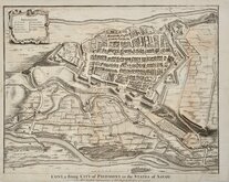
Cuneo Piedmont Savoy 1727
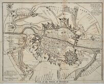
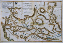
Siege of Tournai 1727
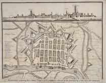
Nieuwpoort Belgium 1727
Vijaydurg Fort 1756
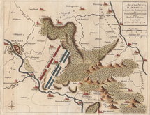
Battle of Hastenbeck 1757
Battle of Kolin 1757

£25 Roman Provinces in France
Ref: dsm2835
Add to
basket
Thanks,Your Product Has Been Added To Basket

31x23 cm
CARTE | DES GAULES | DIVISÉE | en Provinces Romaines | et comprenant | les Conquêtes des Francs | LES POSSESSIONS DES VISIGOTHS | celles des Ostregoths | ET LE ROUYAME DES BOURGUIGNONS | jusqu'au commencement | DU VI.E SIÈCLE.
France divided into Roman Provinces, the conquests of the Franks, possessions of the Visigoths and Ostregoths and the Kingdom of the Bourguignons at the begining of the 6th century.
Steel engraving by Thierry published in Precis de la Geographie Universelle...by Malte-Brun.
Fine example in original hand colour.
Quick Links


Mediterranean

Road Maps
×