
Europe
Historical Maps
( Page 1 of 10 )
Saxon Heptarchy Robert Morden 1695

Roman Britain Robert Morden 1695
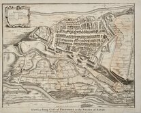
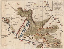
Cuneo Piedmont Savoy 1727
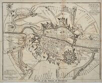
Siege of Tournai 1727
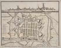
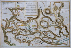
Nieuwpoort Belgium 1727
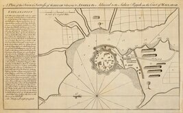
Vijaydurg Fort 1756
Battle of Hastenbeck 1757
Battle of Kolin 1757


£25 O.S.Ancient Britain South
Ref: 1755gm
Add to
basket
Thanks,Your Product Has Been Added To Basket

82x100 cm
SOUTH SHEET
FOREWORD, INTRODUCTION AND COMBINED INDEX TO NORTH AND SOUTH SHEETS OF ANCIENT BRITAIN A MAP OF THE MAJOR VISIBLE ANTIQUITIES OF GREAT BRITAIN OLDER THAN A.D.1066
SCALE: 1/625,000 (or about 10 Miles to One Inch)
Printed and Published by the Director General of the Ordnance Survey, Chessington, Surrey 1951
Card printed covers (16x22cm) Title to front. Index to One Inch Ordnance Maps of Great Britain verso.
Diagram of the National Grid Reference System of Great Britain | Title | Pasted Corrigenda slip July 1951 | Foreword | 4pp. Introduction | 28pp. Combined Index to North and South Sheets.
Fold-out linen backed map ANCIENT BRITAIN NORTH SHEET.
Minor dents and chipping to card covers. Chip to top of spine. Some fading to spine and board edges.
Diagonal crease in margin bottom left corner but map is otherwise in very fine, almost unused condition.
Quick Links


Road Maps

Mediterranean
×