
Europe
Historical Maps
( Page 1 of 10 )
Saxon Heptarchy Robert Morden 1695

Roman Britain Robert Morden 1695
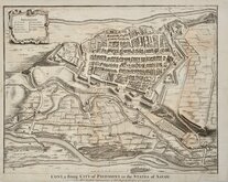
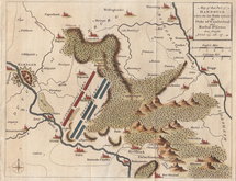
Cuneo Piedmont Savoy 1727
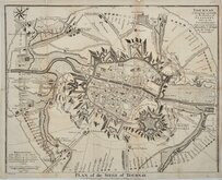
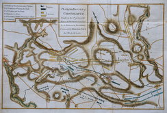
Siege of Tournai 1727
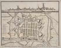
Nieuwpoort Belgium 1727
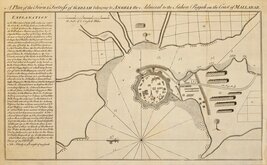
Vijaydurg Fort 1756
Battle of Hastenbeck 1757
Battle of Kolin 1757


101x83 cm
MAP OF MONASTIC BRITAIN (SOUTH SHEET)
SCALE: 1:625,000
Printed and Published by the Director-General of the ORDNANCE SURVEY, CHESSINGTON, SURBITON, SURREY 1954
Printed card covers. Title | Foreword | 8pp. Description. | 16pp. Index to South Sheet. | Linen backed fold-out map.
Covers chipped and front cover splitting from spine now repaired with archival tape inside cover. Booklet detatched (stapled binding). Linen backed map in fine condition.
Quick Links


Road Maps

Mediterranean
×