
Road Maps
Historical Maps
( Page 1 of 10 )
Saxon Heptarchy Robert Morden 1695

Roman Britain Robert Morden 1695
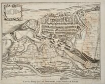
Cuneo Piedmont Savoy 1727
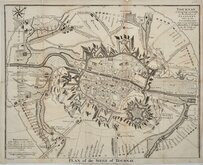
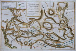
Siege of Tournai 1727
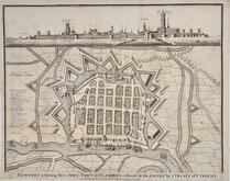
Nieuwpoort Belgium 1727
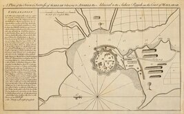
Vijaydurg Fort 1756
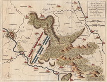
Battle of Hastenbeck 1757
Battle of Kolin 1757


30x23 cm
FRANCE en 1789
Géographie moderne.
Gravé par Thierry. rue des Mathurins S.t Jacques N.o 1.
Steel engraving by Louis-Michel Thierry (fl.1810-1840) published in Geographie Moderne...C. Malte-Brun, Paris, 1839.
Conrad Malte-Brun (1775-1826) Born in Denmark, he became a political activist, was exiled in 1799 and moved to France beginning a carreer in geography and cartography and with French geographer Edme Mentelle produced Geographie mathematique, physique et Politique...1803-1812. He became known as one of the leading French cartographers of his time and died in Paris in 1826 while drafting the final version of his major 8 volume work Precis de Geographie Universelle ou Description de Toutes les parties du Monde Paris 1810-1829. His son, Victor Adolphe Malte-Brun (1816-1889) continued the business publishing maps into the mid 1880's.
Good clean map in original hand colour showing France divided into provinces in 1789.
Quick Links


Europe

Mediterranean
×