
Road Maps
Historical Maps
( Page 1 of 10 )
Saxon Heptarchy Robert Morden 1695

Roman Britain Robert Morden 1695
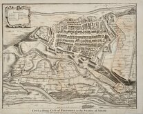
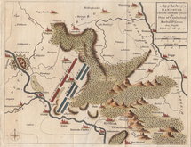
Cuneo Piedmont Savoy 1727
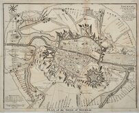
Siege of Tournai 1727
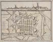
Nieuwpoort Belgium 1727
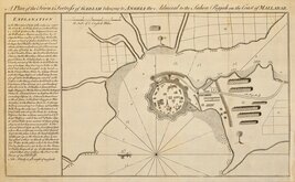
Vijaydurg Fort 1756
Battle of Hastenbeck 1757
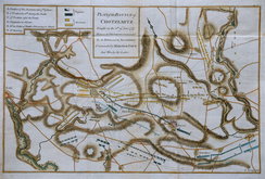
Battle of Kolin 1757


38x29 cm
EMPIRE FRANÇAIS EN 1811.
Gravé par Sengteller. | Dressé par A.T.Chartier Géographe. | La Lettre par Isid Dalmont.
Imp.ie Migeon, 11, rue de Moulin Vert, à Paris.
Steel engraving by Alexander Sengteller showing France divided into departements during the Height of the Napoleonic empire published in Géographie Universelle...J. Migeon, Paris, 1854.
J. Migeon (fl.1855-1899) was a prominent geographer and map publisher based in Paris, his best known works are Géographie Universelle published from 1854 to 1874 and Nouvel Atlas Illustre de Geographie Universelle in 1891. Little is known of his life.
The engraver, Alexander Sengteller was a Polish exile working in Paris. He became engaged for the United States Office of Coast Survey and moved to Washington, D.C. with his son, Louis Alexander, who, at the age of sixteen, also worked for the U.S. Coastal Survey.
Good clean example in original hand colour.
Quick Links


Mediterranean

Europe
×