
Mediterranean
Historical Maps
( Page 1 of 10 )
Saxon Heptarchy Robert Morden 1695

Roman Britain Robert Morden 1695
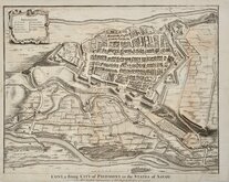
Cuneo Piedmont Savoy 1727
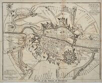
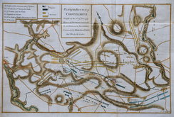
Siege of Tournai 1727
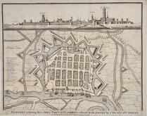
Nieuwpoort Belgium 1727
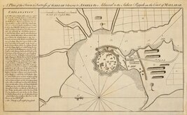
Vijaydurg Fort 1756
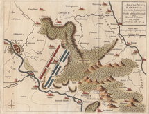
Battle of Hastenbeck 1757
Battle of Kolin 1757


43x30 cm
Set of 7 Maps printed on both sides of two sheets:
SCOTLAND (ROMAN PERIOD)
ENGLAND UNDER THE ROMANS
verso;
SCOTLAND (SAXON PERIOD)
ENGLAND (SAXON PERIOD)
FRANCE ILLUSTRATING THE FRENCH AND ENGLISH WARS.
ENGLAND (TUDOR PERIOD)
verso;
EUROPE (17154-1815) ILLUSTRATING THE WARS OF THE FRENCH REVOLUTION AND NAPOLEON'S WARS.
Each with the imprint: Engraved & Printed | by W. & A.K.Johnston, Edinburgh.
Colour printed lithographs published in The Cosmographic Atlas by W. & A.K.Johnston 1884.
All in good condition.
Approx. size half page maps: 20x30cm.
Approx. size Europe map: 43x30cm.
Quick Links


Europe

Road Maps
×