
Mediterranean
Historical Maps
( Page 1 of 10 )
Saxon Heptarchy Robert Morden 1695

Roman Britain Robert Morden 1695
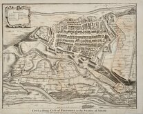
Cuneo Piedmont Savoy 1727
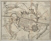
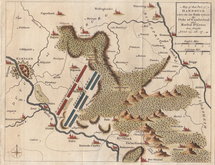
Siege of Tournai 1727
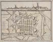
Nieuwpoort Belgium 1727
Vijaydurg Fort 1756
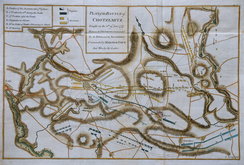
Battle of Hastenbeck 1757
Battle of Kolin 1757


82x66 cm
UNCOMMON HISTORICAL MAP. RARE EARLIER EDITION NOT LISTED IN WHITAKER.
MAP OF BRITISH & ROMAN YORKSHIRE BY CHARLES NEWTON, M.A. OF THE BRITISH MUSEUM
DRAWN & ENGRAVED BY W. HUGHES, F.R.G.S. LONDON MDCCCXLVII
Drawn & Engraved by W. Hughes, 6 Brook St., Holborn, London.
London: Published by the Archaelogical Institute of Great Britain & Ireland, 1847.
Pasted label on back of map and slipcase reads:
MAP OF BRITISH AND ROMAN YORKSHIRE, PREPARED UNDER THE DIRECTION OF THE CENTRAL COMMITTEE OF THE ARCHAEOLOGICAL INSTITUTE FOR THE ANNUAL MEETING AT YORK IN 1846. BY CHARLES NEWTON, M.A. OF THE DEPARTMENT OF ANTIQUITIES, BRITISH MUSEUM.
Prcie to Subscribing members of the Institute, 5s. To non-Subscribers, 7s 6d.
To be purchased at the Office of the Institute, 12, Haymarket, London.
Charles Thomas Newton KCB 1816-1894), British Archaeologist educated at Shrewsbury Schooll, and Christ Church Oxford graduating B.A. in 1837 and M.A. in 1840. Entered the British Museum as assistant in the department of antiquities in 1840. Known for the discovery of the remains of the mausoleum of Helicarnassus, one of the seven wonders of the ancient world. He was made KCB in 1887.
Drawn and engraved by William Hughes (1818? -1876). Born in Westminster about 1818. He was elected FRGS in 1838 and was teacher of Geography and map drawing at St. John's College, Battersea from 1840 and later taught at the Church of England Metropolitan traing College, Highbury, at Kings' College, London, at Queens College Harley Street, and became professor of Geography at Kings College. He catalogued maps and charts at the British Museum 1841-1843 where he presumably met Charles Newton and collaborated on the production of this map.
The map is listed in Whitaker Printed Maps of Yorkshire but with the imprint address as Aldine Chambers. Hughes is recorded at Aldine Chambers from 1851. This map has the Brook Street address which he occupied from 1847 to 1851, and is not listed in Whitaker.
Lithograph printed map segmented and pasted on linen with original hand colouring to key features. Decorated card covers in green cloth slipase. Covers and slipcase with pasted label as above.
Map in very good condition some slight remains of erased pencil notes and marks here and there. Slipcase good with only light fraying to cloth at corners.
A rare early edition of an uncommon map.
Ref. Whitaker Printed Maps of Yorkshire [481]
(This edition is not listed.)
Quick Links


Europe

Road Maps
×