
Mediterranean
Historical Maps
( Page 5 of 10 )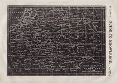
Duke of Marlborough Campaigns 1834
Manuscript map by Adeline 1836
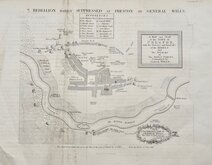
Preston Rebellion General Wills 1836

Europe in the Middle Ages 1837
Europe under Charlemagne 1838
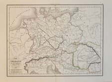
Ancient Germany Delamarche 1839
Malte-Brun 1839
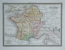
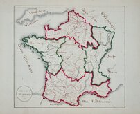
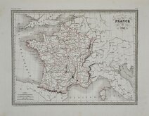
Roman Provinces in France 1842


19x11 cm
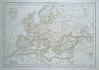
ROUTES OF ALAEXANDER THE GREAT AND DARIUS III TO THE BATTLE OF ISSUS IN SOUTHERN ANATOLIA 333 BC.
Map of the COUNTRY adjacent to ISSUS exhibiting the MARCHES of ALEXANDER AND DARIUS towards that City.
R. Scott Sc.
Published by Khull,Blackie & Co. Glasgow, and A.Fullarton & Co. Edinburgh.
Engraved by Robert Scott (1771-1841), born at Lanark 13 Nov 1771, the son of Robert Scott, a skinner and his wife Grizzell. He was apprenticed to Edinburgh engraver Alexander Robertson. He had premises in Edinburgh from 1797 to 1840, his Parliament Square premises occupied from 1810, were destroyed by fire in 1824. He died in January 1841 reputed to be the finest Scottish engraver of his time. Two of his sons, David Scott (1806-1849) and William Bell Scott (1811-1890) became notable artists.
Published by Khull Blackie & Co. c.1825.
John Blackie, an established Glasgow bookseller in partnership with Archibald Fullarton and William Somerville from 1809, trading as "Blackie, Fullerton & Co." In 1819 John Blackie expanded into printing in partnership with printer Edward Khull in his printing works at East Clyde Street trading as "Khull, Blackie and Co." while the bookselling business continued in Edinburgh as "Fullerton, Somerville and Co."
This small map shows the routes taken by the Macedonian troops under Alexander the Great and the Persian army led by Darius III towards their battle at Issus on 5th November 333 BC. The battle resulted in the defeat of the Persian Army.
Quick Links


Road Maps

Europe
×