
Essex Maps
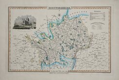
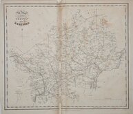
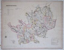
Hertfordshire Maps
( Page 7 of 11 )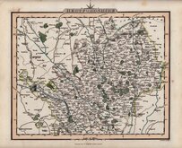
Charles Smith 1822 [c.1829]
Aristide Perrot 1824
William Ebden 1825 [c.1833]
Herman Moll 1826
James Pigot 1826 [1846]
Joseph Cross 1827
Joseph Cross 1827
T L Murray 1830 [1832]


24x21 cm
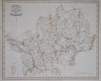
UNCOMMON . SMITH'S "QUARTO" SERIES.
HERTFORDSHIRE
Gardner, Sculpt.
Printed for C. SMITH, No. 172 Strand
Engraved by William Robert Gardner (fl.1816-1829) for Smith’s new English atlas, being a reduction of his folio atlas containing a complete set of county maps…London, C. Smith. 1822
Charles Smith produced a fine series of folio maps of the English Counties in 1801 just prior to John Cary's strikingly similar series published later the same year. This series of smaller maps are also very similar to Cary's 'quarto' maps, drawn on a similar scale and including an almost identical compass device top centre but this time Cary had produced his series in 1787, thirty five years before Smith.
John Cary's publication had undergone about 12 publications, worn plates replaced with a new set and issued a further 5 times before Smith's maps were published. Although issued several times between 1822 and 1844, in contrast to the considerable success of Cary’s work, Smith’s publication came too late to the market, sales were poor and examples are uncommon today.
Occasional spotting in margins and top margin close to North point but still a good example of an uncommon map in original hand colour of the second state of the plate published in 1829 & 1830.
Hodson Printed Maps of Hertfordshire ref.84(ii).
Quick Links


Hertfordshire Prints

Middlesex Maps
×