
Gloucestershire Maps
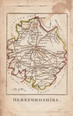
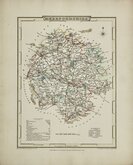
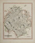
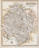
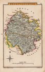
Herefordshire Maps
( Page 2 of 3 )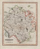
Benjamin Baker 1793
Robert Butters 1803
George Cole 1805
John Cary 1809
George Cole 1810 [c.1838]
Samuel John Neele 1818 [1819]
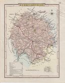
Sidney Hall 1820
John Cary 1822


46x33 cm
CLEAR UNCLUTTERED MAP
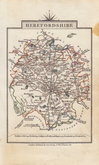
A MAP OF HEREFORDSHIRE ENGRAVED FROM AN ACTUAL SURVEY with Improvements.
London. Engraved for J. Harrison, No.115, Newgate Street, as the Act directs March 24th. 1789.
Haywood del.
This series of county maps were issued at erratic intervals over a four year period bearing dates between 1787 and 1789. The atlas Maps Of The English Counties… was first issued in 1791 by J. Harrison and remained on sale for several years but probably did well as various price reductions are recorded. The border is divided and numbered at 5' intervals with a graticule over the map.
A neatly engraved map showing the roads and the hundred divisions. Good margins. Vertical folds as issued. Good hand colour.
Quick Links


Worcestershire Maps

Wales Maps
×