
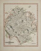
Gloucestershire Maps
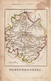
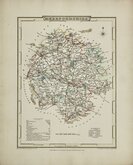
Herefordshire Maps
( Page 2 of 3 )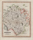
Benjamin Baker 1793
Robert Butters 1803
George Cole 1805
John Cary 1809
George Cole 1810 [c.1838]
Samuel John Neele 1818 [1819]
Sidney Hall 1820
John Cary 1822


22x27 cm
“QUARTO CARY” INCLUDES ORIGINAL PAGE OF TEXT DESCRIPTION
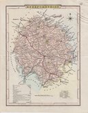
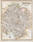
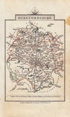
HEREFORDSHIRE
London: Published by J.Cary Engraver & Map seller No.181 Strand July 1st.1809.
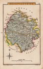
Copper engraving by John Cary. This series of maps, commonly known as his "quarto" series, were published in Cary's New and Correct English Atlas and were justifiably popular, running to many editions from 1787 until about 1804. Re-engraved plates extended the life of the series from 1808 to 1843 and lithographic transfers from the plates by later publishers continued publication until about 1876 - a life of nearly 90 years.
This map of Herefordshire is the first state of the re-engraved plate published in Cary's New and Correct English Atlas 1809.
A lovely example in fine original hand colour. Includes original typeset page of text description of the county.
Quick Links


Wales Maps

Worcestershire Maps
×