
Wiltshire Maps
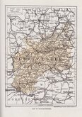
Gloucestershire Maps
( Page 3 of 3 )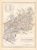
Sidney Hall 1833 [1852]
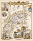
Thomas Moule 1837 [1842]
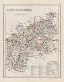
Joshua Archer 1842 [1848]
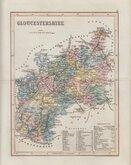
Josua Archer 1842 [1858]
Francis Weller 1891
Geographia 1924
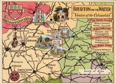
Bourton on the Water Postcard 1965


12x7 cm
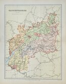
COLOURFUL MINIATURE MAP.
GLOUCESTERSHIRE
Pub. by S.Leigh,18,Strand. | Sidy. Hall sculpt.
Miniature map engraved by Sidney Hall and first published by Samuel Leigh in Leigh's New Pocket Atlas of England and Wales in 1820. The demand for pocket atlases for the traveller was high during the first half of the 19th century and this little atlas, Samuel Leigh's only cartographic work, was very popular, running to ten editions with further issues after his death by his widow Selina and then his son until 1839. The plates were then acquired by George Biggs who published them until 1843.
Sidney Hall (1788?-1831), began work as an engraver about 1809 and was in partnership with Michael Thomson (fl.1809-1815) as "Thomson & Hall" in 1814. Hall was a pioneer of engraving on steel and is almost certainly the first engraver to use steel plates for map engraving, producing steel engraved maps from 1821. He married Selina Price in 1821 but died early in 1831 aged forty-two. Selina carried on his engraving business signing her maps "S. Hall" which has caused some confusion in map bibliographies.
Title and imprint engraved sideways.
Good hand coloured example in the first state of the plate published between 1820 & 1831.
SPECIAL OFFER MOUNT OPTION AVAILABLE ON THIS ITEM AT CHECKOUT FOR UK CUSTOMERS.
Quick Links

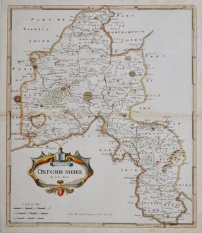
Oxfordshire Maps

Somerset Maps
×